Below are the stats for my recent Sierra-Cascades bike trip.
Total Miles Travelled by Bicycle: 2,384
Total Time in Saddle: 228 hours, 48 minutes
(equal to 9 days, 12 hours, 48 minutes)
# of Trip Days: 50
# of Riding Days: 45
# of Rest Days: 5
Max # of Consecutive Riding Days: 13
Monday, June 30, 2014
Sunday, June 29, 2014
Day #50: Riding Forever on the Last Day
Today's Route: Arlington, WA to Bellingham, WA (96 miles)
Total Trip Miles: 2,384
We performed our morning rituals for the final time this morning, as today was the last day of our trip. Our route was straight-forward; we would follow Highway 9 from Arlington to Sumas.
Highway 9 was a gorgeous road. Though mostly flat, the road offered tantalizing views of the snow-covered Cascades off to the east.
The first 25 miles or so of the highway followed the western border of The Rectangle Ride (see Bloated Fish & Butt Raisins). I've ridden The Rectangle Ride four times before, and so one would assume that all the sites along this road would be familiar to me. However, every time I've biked The Rectangle Ride, I've biked counterclockwise around the rectangle, meaning that I've biked along Highway 9 from north to south. Today we road from south to north, and so I was able to experience the route from a different angle. Doing so enabled me to see new things, such as this funny sign:
Total Trip Miles: 2,384
We performed our morning rituals for the final time this morning, as today was the last day of our trip. Our route was straight-forward; we would follow Highway 9 from Arlington to Sumas.
Highway 9 was a gorgeous road. Though mostly flat, the road offered tantalizing views of the snow-covered Cascades off to the east.
 |
| A peek at the North Cascade peaks. |
The first 25 miles or so of the highway followed the western border of The Rectangle Ride (see Bloated Fish & Butt Raisins). I've ridden The Rectangle Ride four times before, and so one would assume that all the sites along this road would be familiar to me. However, every time I've biked The Rectangle Ride, I've biked counterclockwise around the rectangle, meaning that I've biked along Highway 9 from north to south. Today we road from south to north, and so I was able to experience the route from a different angle. Doing so enabled me to see new things, such as this funny sign:
Thursday, June 26, 2014
Day #49: Urban Trails
Today's Route: Seattle, WA to Arlington, WA (67 miles)
Total Trip Miles: 2,288
Having celebrated the solstice in Seattle yesterday, we are back on the road today to finish our final two days of pedaling.
Though today's route passed through a number of towns near to home, the route included sections of urban trails on which I have not yet ridden.
For the first 36 miles of our route, Alex and I had the pleasure of having Ferit join us for the ride.
The first part of the route was along the Lake Washington Loop. I've ridden this route a million times before, though this was the first time I ever stopped to pose for a photo with the awesome cyclist suspended from a tree:
The second urban trail we followed today was the Interurban Trail. Though I have ridden the Interurban many times close to the Seattle area, I had never followed the trail as far north as Everett. It is a so-so trail -- one that would definitely benefit from better signage and fewer stop signs.
Total Trip Miles: 2,288
Having celebrated the solstice in Seattle yesterday, we are back on the road today to finish our final two days of pedaling.
Though today's route passed through a number of towns near to home, the route included sections of urban trails on which I have not yet ridden.
For the first 36 miles of our route, Alex and I had the pleasure of having Ferit join us for the ride.
The first part of the route was along the Lake Washington Loop. I've ridden this route a million times before, though this was the first time I ever stopped to pose for a photo with the awesome cyclist suspended from a tree:
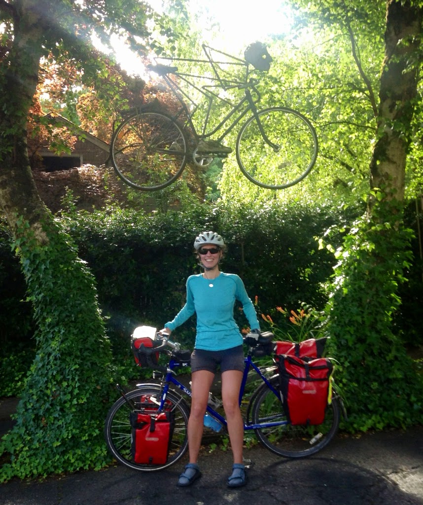 |
| The suspended cyclist, along the Lake Washington loop. |
The second urban trail we followed today was the Interurban Trail. Though I have ridden the Interurban many times close to the Seattle area, I had never followed the trail as far north as Everett. It is a so-so trail -- one that would definitely benefit from better signage and fewer stop signs.
Wednesday, June 25, 2014
Day #48: Celebrating the Solstice
Today's Route: Rest Day in Seattle (6 miles)
Total Trip Miles: 2,221
As fate would have it, our rest day in Seattle happened to coincide with the annual Fremont Solstice Parade. Fate was clearly telling me that this was the year to ride my bicycle in the parade.
Are you ready for a little game? Here we go! Look at the two photos below. Can you spot the differences?
Yup, you're right on! In the second photo, Alex is in front, Alex is wearing a helmet, and we're riding on gravel instead of a paved road. Can you spot any other differences?
Total Trip Miles: 2,221
As fate would have it, our rest day in Seattle happened to coincide with the annual Fremont Solstice Parade. Fate was clearly telling me that this was the year to ride my bicycle in the parade.
Are you ready for a little game? Here we go! Look at the two photos below. Can you spot the differences?
 |
| A photo of me and Alex, from my A Commercial Break post. (Photo by Ferit.) |
 |
| Alex and me, riding in today's Fremont Solstice Parade. (Photo by Ferit.) |
Yup, you're right on! In the second photo, Alex is in front, Alex is wearing a helmet, and we're riding on gravel instead of a paved road. Can you spot any other differences?
Tuesday, June 24, 2014
Day #47: Sweet Home Seattle
Today's Route: Parkland, WA to Seattle, WA (51 miles)
Total Trip Miles: 2,215
Today was all about pedaling, because tonight we knew we'd have warm showers and comfy beds in our hometown of Seattle.
Somewhere along the route, I stopped long enough to pick some flowers and to arrange them in my handlebar vase.
Somewhere along the route, we also came across this crazy guy, who was standing on the side of the road, lifting his lightweight bicycle with one finger. Oh wait, that crazy guy is Ferit!
Total Trip Miles: 2,215
Today was all about pedaling, because tonight we knew we'd have warm showers and comfy beds in our hometown of Seattle.
Somewhere along the route, I stopped long enough to pick some flowers and to arrange them in my handlebar vase.
 |
| A bouquet of flowers, to welcome me back to Seattle. |
Somewhere along the route, we also came across this crazy guy, who was standing on the side of the road, lifting his lightweight bicycle with one finger. Oh wait, that crazy guy is Ferit!
Friday, June 20, 2014
Day #46: Cartwheeling for Joy
Today's Route: Castle Rock, WA to Parkland, WA (89 miles)
Total Trip Miles: 2,164
Ever since we entered Washington state yesterday, I've had a hard time remembering that we've crossed into a new state.
As you may recall, when we've crossed other state boundaries, we've jumped for joy at the "Welcome to [State]" signs. This joyous burst of energy has helped my brain to remember the crossing.
Since there was no "Welcome to Washington" sign along our route, I thought that perhaps cartwheeling for the pure joy of being in Washington might help to make me feel as though we were now in our home state. At a grocery stop in Napavine, I cartwheeled for joy on the green Washington grass.
 |
| Cartwheeling for joy (part one). |
Day #45: The STP -- In Reverse
Today's Route: Portland, OR to Castle Rock, WA (69 miles)
Total Trip Miles: 2,075
Alex had the directions for our new route on his phone. For the first ten miles of our ride this morning, we'd memorize two or three of the turns, ride one or two of the turns (because we'd forget the third), and then pull over on the side of road to look at the phone for the next few turns. Ah ya ya! This form of navigation was going to take forever!
I proposed that we write down the turns.
Alas, we didn't have any paper. We pulled over at a gas station, and I went to the bathroom to get some paper towels. The paper towels served perfectly for capturing our directions in an easily accessible manner.
In a nutshell, our ride north will follow the Seattle-to-Portland ride (aka "The STP") -- in reverse.
Total Trip Miles: 2,075
Alex had the directions for our new route on his phone. For the first ten miles of our ride this morning, we'd memorize two or three of the turns, ride one or two of the turns (because we'd forget the third), and then pull over on the side of road to look at the phone for the next few turns. Ah ya ya! This form of navigation was going to take forever!
I proposed that we write down the turns.
Alas, we didn't have any paper. We pulled over at a gas station, and I went to the bathroom to get some paper towels. The paper towels served perfectly for capturing our directions in an easily accessible manner.
 |
| Our route, handwritten with a quill pen on fancy brown paper. |
In a nutshell, our ride north will follow the Seattle-to-Portland ride (aka "The STP") -- in reverse.
Wednesday, June 18, 2014
Day #44: P-Town & The S-Word
Today's Route: Sublimity, OR to Portland, OR (69 miles)
Total Trip Miles: 2,006
We passed 2,000 on the odometer today. Woohoo!
We also passed through more gorgeous scenery on our ride though Oregon this morning.
As you likely recall, yesterday we decided that we would take a different route to the Candian border; we would parallel the I-5 corridor. As we traced our fingers along the corridor, northward from Sublimity, the word "Portland" was like a flashing neon sign. It was the perfect distance away for our next day's riding goal.
Total Trip Miles: 2,006
We passed 2,000 on the odometer today. Woohoo!
We also passed through more gorgeous scenery on our ride though Oregon this morning.
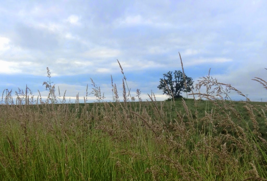 |
| A lone tree proudly stands by itself. |
 |
| A colorful pasture. |
As you likely recall, yesterday we decided that we would take a different route to the Candian border; we would parallel the I-5 corridor. As we traced our fingers along the corridor, northward from Sublimity, the word "Portland" was like a flashing neon sign. It was the perfect distance away for our next day's riding goal.
Tuesday, June 17, 2014
A Commercial Break
And now...for a break from our regularly scheduled programming.
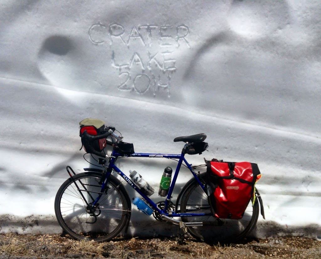
I would like share the below photos, which were taken by Ferit.
I would like share the below photos, which were taken by Ferit.
 |
| Riding along a snowdrift at Crater Lake. |
Day #43: Soggy with Sublimity Salvation
Today's Route: Blue Bay Campground (14 miles N of Sisters, OR) to Sublimity, OR (87 miles)
Total Trip Miles: 1,937
We woke up to more rain, which meant packing away soggy tents. While packing away a soggy tent is fine and dandy, putting up a soggy tent the next night is not a good thing. We would need to find a way to dry our tents.
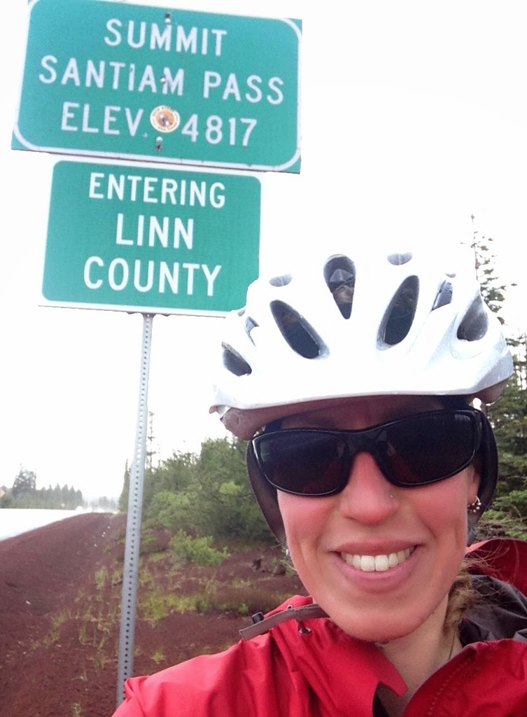
We began our morning with a climb up and over Santiam Pass. Near the top of the summit, the rain turned to snow. Goody, more snow!
Being wet, in and of itself, is not a big deal. Likewise, being cold, in and of itself, is not a big deal. But when you combine wet and cold, the combination is not pretty. Particularly when you're descending at fast speeds, such that wind also becomes a factor.
Total Trip Miles: 1,937
We woke up to more rain, which meant packing away soggy tents. While packing away a soggy tent is fine and dandy, putting up a soggy tent the next night is not a good thing. We would need to find a way to dry our tents.
We began our morning with a climb up and over Santiam Pass. Near the top of the summit, the rain turned to snow. Goody, more snow!
 |
| Snowflakes at the top of Santiam Pass. |
Being wet, in and of itself, is not a big deal. Likewise, being cold, in and of itself, is not a big deal. But when you combine wet and cold, the combination is not pretty. Particularly when you're descending at fast speeds, such that wind also becomes a factor.
Day #42: A Few Steps Forwards & 20 Miles Backwards
Today's Route: Bend, OR to Blue Bay Campground (14 miles N of Sisters, OR) (50 miles)
Total Trip Miles: 1,850
This morning as we cycled, we enjoyed a fantastic view of The Sisters in the distance.
Here's another view of The Sisters, with a neat horse sculpture in the foreground:
Riding through Oregon today made me think of this wonderful ad promoting bike tourism in Oregon.
Total Trip Miles: 1,850
This morning as we cycled, we enjoyed a fantastic view of The Sisters in the distance.
 |
| The Sisters in the distance. |
Here's another view of The Sisters, with a neat horse sculpture in the foreground:
 |
| Horses riding in front of The Sisters. |
Riding through Oregon today made me think of this wonderful ad promoting bike tourism in Oregon.
Sunday, June 15, 2014
Day #41: A Bittersweet Reunion
Today's Route: Chemult, OR to Bend, OR (73 miles)
Total Trip Miles: 1,800
Randy rode the ten miles to Chemult and pulled into our motel parking lot at 9:30am on-the-dot. It was so great to see his smiling face.
Randy was riding off the Sierra-Cascades route today. He was going to follow Route 97 straight north to meet up with a friend of his for a few days.
After looking at an Oregon map, Alex and I realized that if we also took Route 97 straight north, we could shave a number of miles off of our ride.
Option A: Stick with the original Sierra-Cascades route. This means more miles and no riding with Randy.
Option B: Ride north on Route 97. This means shaving miles off the route and being able to ride with Randy.
Total Trip Miles: 1,800
Randy rode the ten miles to Chemult and pulled into our motel parking lot at 9:30am on-the-dot. It was so great to see his smiling face.
 |
| Randy and me. |
Randy was riding off the Sierra-Cascades route today. He was going to follow Route 97 straight north to meet up with a friend of his for a few days.
After looking at an Oregon map, Alex and I realized that if we also took Route 97 straight north, we could shave a number of miles off of our ride.
Option A: Stick with the original Sierra-Cascades route. This means more miles and no riding with Randy.
Option B: Ride north on Route 97. This means shaving miles off the route and being able to ride with Randy.
Day #40: Snowpocalypse!
Today's Route: Crater National Park (along the west rim) to Chemult, OR (48 miles)
Total Trip Miles: 1,727
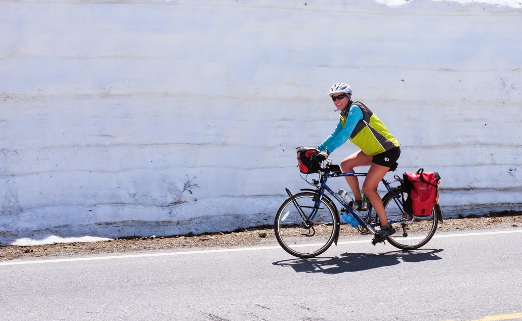
Last night we checked the forecast and learned that there was a chance of precipitation overnight. At the higher elevations, the precipitation would likely be in the form of snow.
We awoke this morning to hear precipitation gently falling on the tent; this was snow. At times, the precipitation was a bit louder; this was sleet. Lovely!
Alex and I decided to delay our typical 7am-leave-from-camp departure time. We hoped that the precipitation would die off by 11am, as the forecast had predicted.
We parted ways with Ferit and Dilek, who are heading west to enjoy the Oregon coast through the remainder of the weekend. Thanks, you two, for spending a few days of your trip with us. It was great spending time with you, and our stomachs are forever grateful for the many meals you prepared for us.
At 11am, rain droplets and snowflakes were still falling from the sky. Alex and I decided to start our ride anyway, very well knowing that we still had 1,500 ft to climb before we reached the highest point along Crater Lake.
There's a first time for everything, and this was my first time I encountered snow on a bike tour. Alex and I were laughing about how we've experienced a whole range of temperatures and weather conditions on this trip.
Total Trip Miles: 1,727
Last night we checked the forecast and learned that there was a chance of precipitation overnight. At the higher elevations, the precipitation would likely be in the form of snow.
We awoke this morning to hear precipitation gently falling on the tent; this was snow. At times, the precipitation was a bit louder; this was sleet. Lovely!
Alex and I decided to delay our typical 7am-leave-from-camp departure time. We hoped that the precipitation would die off by 11am, as the forecast had predicted.
We parted ways with Ferit and Dilek, who are heading west to enjoy the Oregon coast through the remainder of the weekend. Thanks, you two, for spending a few days of your trip with us. It was great spending time with you, and our stomachs are forever grateful for the many meals you prepared for us.
At 11am, rain droplets and snowflakes were still falling from the sky. Alex and I decided to start our ride anyway, very well knowing that we still had 1,500 ft to climb before we reached the highest point along Crater Lake.
 |
| Riding through a light, wet snowfall. |
There's a first time for everything, and this was my first time I encountered snow on a bike tour. Alex and I were laughing about how we've experienced a whole range of temperatures and weather conditions on this trip.
Day #39: The Bestest Day Ride Ever
Today's Route: The East Rim of Crater Lake (28 miles)
Total Trip Miles: 1,679
One of the most popular day rides in the Pacific Northwest is the 33-mile long ride along the rim of Crater Lake. I've wanted to do this ride for a long time. Since we were passing through Crater Lake, now was the perfect time to make that ride happen.
The Crater Lake area is one of the snowiest places in the Pacific Northwest. On average, it receives 44 ft of snowfall each year. Because of the heavy snowfall, the road around the rim of the lake is only accessible for a few short months each year -- typically in July, August, and September.
Total Trip Miles: 1,679
One of the most popular day rides in the Pacific Northwest is the 33-mile long ride along the rim of Crater Lake. I've wanted to do this ride for a long time. Since we were passing through Crater Lake, now was the perfect time to make that ride happen.
 |
| Snow-side graffiti. |
The Crater Lake area is one of the snowiest places in the Pacific Northwest. On average, it receives 44 ft of snowfall each year. Because of the heavy snowfall, the road around the rim of the lake is only accessible for a few short months each year -- typically in July, August, and September.
Day #38: Crater Lake
Today's Route: River Bridge Campground (6 miles N of Prospect, OR) to Crater Lake National Park (27 miles)
Total Trip Miles: 1,651
Today we entered Crater Lake National Park!
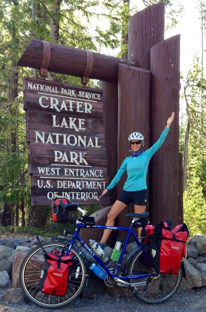 |
| At the entrance to Crater Lake National Park. |
Crater Lake was created 7,700 years ago, when 12,000 ft high Mount Mazama collapsed in a massive volcanic eruption. The explosion created a 4,000 ft deep caldera. The caldera later filled with water to create Crater Lake.
Day #37: An Uneventful Ride
Today's Route: Ashland, OR to River Bridge Campground (6 miles N of Prospect, OR) (81 miles)
Total Trip Miles: 1,624
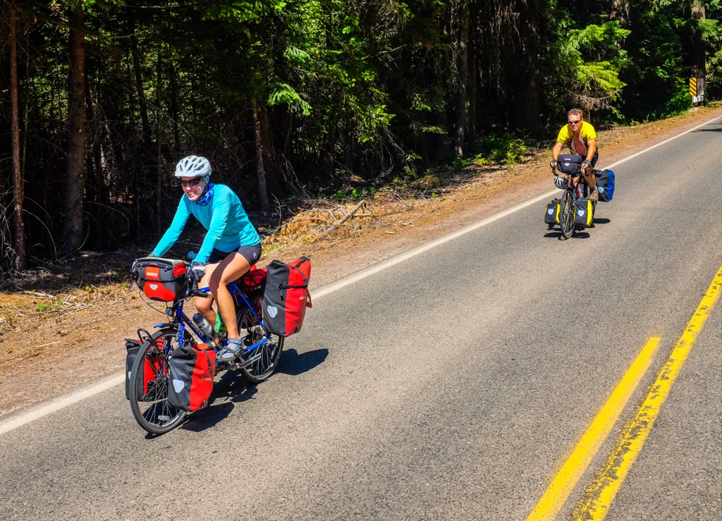
It was a long, but uneventful, ride today. Below is a photo that Randy took of Alex and me as we rode through California a number of days ago. Given that we wear the same clothes day-in and day-out, this is also what Alex and I looked like riding today. Though, of course, you'll need to swap out the California scenery with Oregon scenery.
As Alex spent the rest day yesterday at a hotel in Ashland, and as I camped with Ferit and Dilek just outside of Ashland, the first order of business was to meet up with Alex so that we could begin our ride together. Alex and I met up at the corner of Dead Indian Memorial Road, where we would begin the morning with a 15-mile climb.
Total Trip Miles: 1,624
It was a long, but uneventful, ride today. Below is a photo that Randy took of Alex and me as we rode through California a number of days ago. Given that we wear the same clothes day-in and day-out, this is also what Alex and I looked like riding today. Though, of course, you'll need to swap out the California scenery with Oregon scenery.
 |
| Me and Alex riding. (Photo by Randy.) |
As Alex spent the rest day yesterday at a hotel in Ashland, and as I camped with Ferit and Dilek just outside of Ashland, the first order of business was to meet up with Alex so that we could begin our ride together. Alex and I met up at the corner of Dead Indian Memorial Road, where we would begin the morning with a 15-mile climb.
Saturday, June 14, 2014
Day #36: A Rest Day in Ashland
Today's Route: Rest Day in Ashland (0 miles)
Total Trip Miles: 1,543
Today is a rest day in Asland.
Alex woke up early in the morning, packed up his things, and headed to a hotel for his rest day. Ferit, Dilek, and I decided we'd spend another night at the campground.
We began the morning with a delicious breakfast.
We then drove into downtown Ashland. Ashland is an adorable little town. It's best known for its popular Shakespeare Festival. As there were no going-ons at the festival today, we began our visit to town by hanging out a coffee shop for a bit.
Total Trip Miles: 1,543
Today is a rest day in Asland.
Alex woke up early in the morning, packed up his things, and headed to a hotel for his rest day. Ferit, Dilek, and I decided we'd spend another night at the campground.
We began the morning with a delicious breakfast.
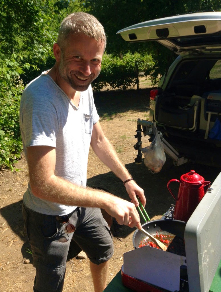 |
| Chef Ferit, preparing breakfast. |
We then drove into downtown Ashland. Ashland is an adorable little town. It's best known for its popular Shakespeare Festival. As there were no going-ons at the festival today, we began our visit to town by hanging out a coffee shop for a bit.
Day #35: Oregon or Bust
Today's Route: Mt Shasta, CA to Ashland, OR (85 miles)
Total Trip Miles: 1,543
Ron joined us for the first 30 miles of our ride leaving Mt Shasta this morning. For a roadie to be able to pedal slowly enough to keep up with two heavily loaded touring cyclists gives credence to Ron's immense patience.
Although Ron is a cyclist, he has never toured before. He very much wants to try self-contained touring. Ron has his eyes set on riding the Pacific Coast for his first tour. I can't think of a better route to ensure that Ron falls in love with the touring lifestyle.
Total Trip Miles: 1,543
Ron joined us for the first 30 miles of our ride leaving Mt Shasta this morning. For a roadie to be able to pedal slowly enough to keep up with two heavily loaded touring cyclists gives credence to Ron's immense patience.
 |
| Alex & Ron. |
Although Ron is a cyclist, he has never toured before. He very much wants to try self-contained touring. Ron has his eyes set on riding the Pacific Coast for his first tour. I can't think of a better route to ensure that Ron falls in love with the touring lifestyle.
Monday, June 9, 2014
Day #34: Mt Shasta Explodes
Today's Route: Burney Falls Trailer Resort (26.2 miles N of Old Station, CA) to Mt Shasta, CA (57 miles)
Total Trip Miles: 1,458
It's one of those rare one-photo blog days. Here it is, a photo of Mt Shasta, as we rode into the town bearing the same name:
Today was a straight-forward riding day. We climbed a couple of summits, we passed through one (and only one) town, and then we arrived at Mt Shasta.
Total Trip Miles: 1,458
It's one of those rare one-photo blog days. Here it is, a photo of Mt Shasta, as we rode into the town bearing the same name:
 |
| Mt Shasta. |
Today was a straight-forward riding day. We climbed a couple of summits, we passed through one (and only one) town, and then we arrived at Mt Shasta.
Friday, June 6, 2014
Day #33: Lassen Magnificence
Today's Route: Childs Meadow RV Resort (9 miles S of Lassen National Park) to Burney Falls Trailer Resort (26.2 miles N of Old Station, CA) (82 miles)
Total Trip Miles: 1,417
As a follow-up to yesterday's blog entry, self-dismemberment of body parts was not required on today's ride. All body parts dutifully cooperated. And that was most appreciated because...
Today's ride included a 29-mile tour through Lassen Volcanic National Park.
Mount Lassen erupted numerous times between 1914 and 1917. The largest eruption, which was in 1915, resulted in ash settling more than 200 miles to the east. Mt Lassen was the last volcano to erupt in the Cascades range, until Mt St Helen's blew its top on May 18, 1980.
Total Trip Miles: 1,417
As a follow-up to yesterday's blog entry, self-dismemberment of body parts was not required on today's ride. All body parts dutifully cooperated. And that was most appreciated because...
Today's ride included a 29-mile tour through Lassen Volcanic National Park.
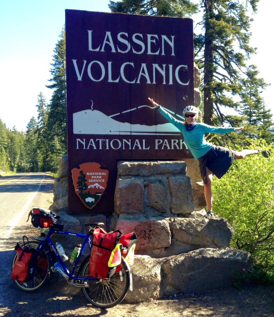 |
| At the entrance to Lassen. |
Mount Lassen erupted numerous times between 1914 and 1917. The largest eruption, which was in 1915, resulted in ash settling more than 200 miles to the east. Mt Lassen was the last volcano to erupt in the Cascades range, until Mt St Helen's blew its top on May 18, 1980.
Day #32: Body Parts in a Pannier
Today's Route: Quincy, CA to Childs Meadow RV Resort (9 miles S of Lassen National Park) (66 miles)
Total Trip Miles: 1,335
The day started out wonderfully. We rode two miles into Quincy, stocked up on groceries for the next few days, and then spent an hour or so at a coffee shop. I ordered a pot of Jasmine tea. Yum!
We chatted with the coffee shop proprietor for awhile. As it turns out, he spent forty or so years in Seattle prior to moving out to Quincy just a year ago to open the coffee shop. His wife's family is from the Quincy area, and her wanting to be closer to her family was the main impetus for the move.
When the coffee shop owner was in Seattle, he worked in real estate. One of his jobs was to help Amazon employees relocate to Seattle. Alex and I mentioned that we both used to work at Amazon. It's a small world, I tell you.
Total Trip Miles: 1,335
The day started out wonderfully. We rode two miles into Quincy, stocked up on groceries for the next few days, and then spent an hour or so at a coffee shop. I ordered a pot of Jasmine tea. Yum!
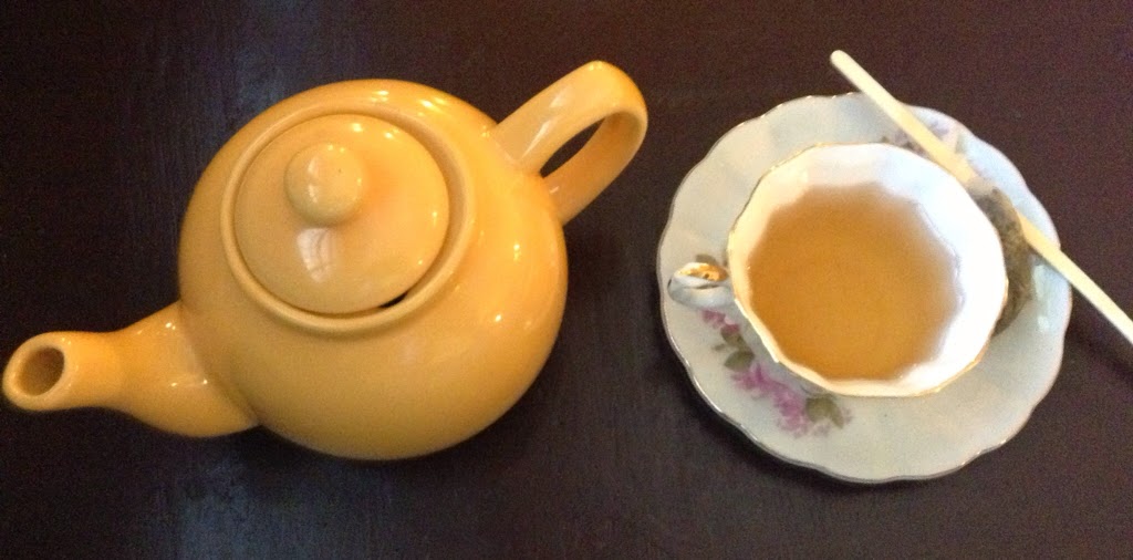 |
| My pot of Jasmine tea. |
We chatted with the coffee shop proprietor for awhile. As it turns out, he spent forty or so years in Seattle prior to moving out to Quincy just a year ago to open the coffee shop. His wife's family is from the Quincy area, and her wanting to be closer to her family was the main impetus for the move.
When the coffee shop owner was in Seattle, he worked in real estate. One of his jobs was to help Amazon employees relocate to Seattle. Alex and I mentioned that we both used to work at Amazon. It's a small world, I tell you.
Thursday, June 5, 2014
Day #31: Summit Surprises
Today's Route: Granite Flat Campground (4 miles S of Truckee, CA) to Quincy, CA (74 miles)
Total Trip Miles: 1,269
The Sierra-Cascades route is broken down into five separate maps. Today we began following the third map. Although we have completed only ⅖ of the maps, we've ridden more than half of the 2,400 miles of this trip.
The toughest climbs of the Sierra-Cascades ride are in the southern half of the route. So, the most difficult part of the ride is behind us. Since we're in decent physical shape now, and since the route is getting easier, we anticipate riding more miles per day moving forward.
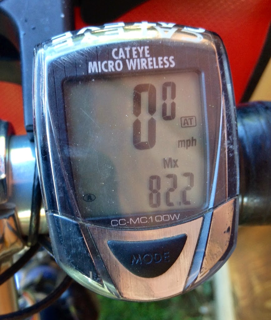
Today was one of those higher mileage days. Today we rode 74 miles.
My bike computer shows that my max speed for today was 82.2 miles per hour. Pretty spectacular, eh?
We passed through the lovely town of Truckee very early in the morning. Truckee is an adorable little town, in a gorgeous mountain setting. For many years, Truckee was a popular location for shooting Hollywood films.
Total Trip Miles: 1,269
The Sierra-Cascades route is broken down into five separate maps. Today we began following the third map. Although we have completed only ⅖ of the maps, we've ridden more than half of the 2,400 miles of this trip.
The toughest climbs of the Sierra-Cascades ride are in the southern half of the route. So, the most difficult part of the ride is behind us. Since we're in decent physical shape now, and since the route is getting easier, we anticipate riding more miles per day moving forward.
Today was one of those higher mileage days. Today we rode 74 miles.
My bike computer shows that my max speed for today was 82.2 miles per hour. Pretty spectacular, eh?
 |
| I have 100% faith in my electronic devices. |
We passed through the lovely town of Truckee very early in the morning. Truckee is an adorable little town, in a gorgeous mountain setting. For many years, Truckee was a popular location for shooting Hollywood films.
Wednesday, June 4, 2014
Day #30: Here Comes Tahoe & There Goes Tahoe
Today's Route: Hope Valley Resort (5 miles W of Woodfords, CA) to Granite Flat Campground (2 miles S of Truckee, CA) (59 miles)
Total Trip Miles: 1195
It was a sad morning.
This morning we parted ways with Randy, our dear lifelong friend of 14 days. I knew this time would eventually come, but I was hoping it would happen much, much later. Or perhaps even never.
Our timeframes and paths are unfortunately starting to diverge. Randy will be spending some time with a friend in Eugene, OR, before he continues north to Portland, OR for the Blues Fest, which is held at the beginning of July. Alex and I, on the other hand, are continuing along the Sierra-Cascades route until we reach the Canadian border. We need to reach our destination and return to Seattle by the end of June.
Alex and I left a note for Randy on the sign post for Luther Pass, which we climbed this morning before reaching Tahoe.
Sure enough, we received a photo later in the day from Randy. He had taken a picture of his bike next to the pass sign. Bless his little heart. I guess I won't be surprised if Randy sends us a photo of him jumping for joy next to the "Welcome to Oregon" sign.
Total Trip Miles: 1195
It was a sad morning.
This morning we parted ways with Randy, our dear lifelong friend of 14 days. I knew this time would eventually come, but I was hoping it would happen much, much later. Or perhaps even never.
Our timeframes and paths are unfortunately starting to diverge. Randy will be spending some time with a friend in Eugene, OR, before he continues north to Portland, OR for the Blues Fest, which is held at the beginning of July. Alex and I, on the other hand, are continuing along the Sierra-Cascades route until we reach the Canadian border. We need to reach our destination and return to Seattle by the end of June.
Alex and I left a note for Randy on the sign post for Luther Pass, which we climbed this morning before reaching Tahoe.
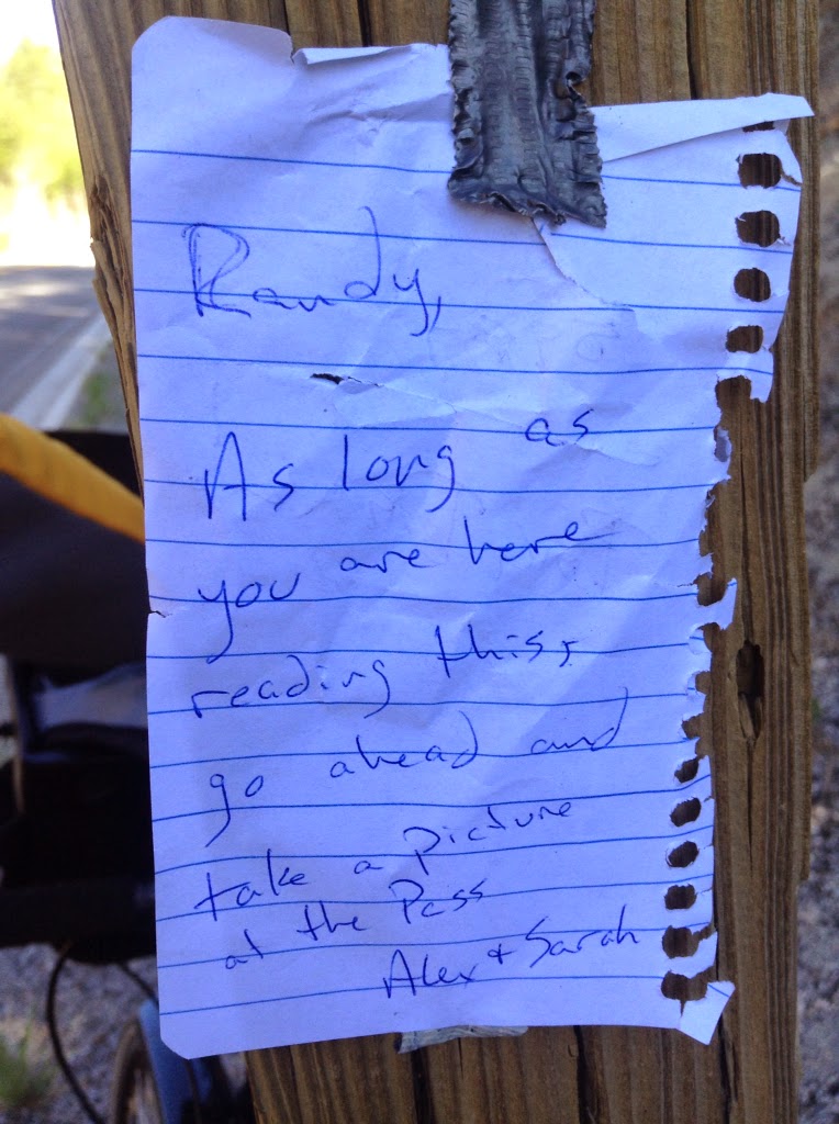 |
| Our note for Randy. |
Sure enough, we received a photo later in the day from Randy. He had taken a picture of his bike next to the pass sign. Bless his little heart. I guess I won't be surprised if Randy sends us a photo of him jumping for joy next to the "Welcome to Oregon" sign.
Tuesday, June 3, 2014
Day #29: Crossing Borders
Today's Route: Bootleg Campground (8 miles S of Walker, CA) to Hope Valley Resort (5 miles W of Woodfords, CA) (61 miles)
Total Trip Miles: 1,136
Yesterday, I used the Buff in bank-robber mode to keep the flying gnat-like creatures away from entering the orifices of my head.
This morning I looked equally dorky. Only this time, I wore my balaclava to keep my head from freezing. It was damn chilly this morning, especially since the first eight miles of our ride were downhill, in a rocky canyon. The sun had not yet risen above the canyon walls to warm up the air.
On the bright side, my balaclava was one piece of gear that I had packed but not yet used. Now I've used it. So, yeah!
Total Trip Miles: 1,136
Yesterday, I used the Buff in bank-robber mode to keep the flying gnat-like creatures away from entering the orifices of my head.
This morning I looked equally dorky. Only this time, I wore my balaclava to keep my head from freezing. It was damn chilly this morning, especially since the first eight miles of our ride were downhill, in a rocky canyon. The sun had not yet risen above the canyon walls to warm up the air.
 |
| Wearing my balaclava, also in bank-robber mode. |
On the bright side, my balaclava was one piece of gear that I had packed but not yet used. Now I've used it. So, yeah!
Monday, June 2, 2014
Day #28: A Girl Has Gotta Do What a Girl Has Gotta Do
Today's Route: Lee Vining, CA to Bootleg Campground (8 miles south of Walker, CA) (51 miles)
Total Trip Miles: 1,075
The day started with a long slog up and out of the town of Lee Vining. This meant an average pace of roughly 5 mph as we climbed. There were some sort of gnat-like flying creatures, and they were EVERYWHERE. They were flying in our mouths. In our noses. In our ears. It seemed as though every two stroke we were either swatting at the little boogers or spitting them out from our mouths.
After a few miles of riding through these masses of flying annoyances, I finally stopped to rearrange my Buff (the blue thing I wear around my neck to help prevent sunburn) into bank-robber mode. The Buff did a great job of keeping the creatures out of my nose and mouth, with the trade-off being that it was a wee bit more difficult to suck air as I climbed.
Oh, and those nasty little boogers left round, red bite marks all over my arms and legs. Grrr.
Total Trip Miles: 1,075
The day started with a long slog up and out of the town of Lee Vining. This meant an average pace of roughly 5 mph as we climbed. There were some sort of gnat-like flying creatures, and they were EVERYWHERE. They were flying in our mouths. In our noses. In our ears. It seemed as though every two stroke we were either swatting at the little boogers or spitting them out from our mouths.
After a few miles of riding through these masses of flying annoyances, I finally stopped to rearrange my Buff (the blue thing I wear around my neck to help prevent sunburn) into bank-robber mode. The Buff did a great job of keeping the creatures out of my nose and mouth, with the trade-off being that it was a wee bit more difficult to suck air as I climbed.
 |
| Wearing my Buff in bank robber mode. A girl has gotta do what a girl has gotta do. |
Oh, and those nasty little boogers left round, red bite marks all over my arms and legs. Grrr.
Sunday, June 1, 2014
Day #27: It's All Downhill From Here
Today's Route: Crane Flat Campground in Yosemite National Park to Lee Vining, CA (62 miles)
Total Trip Miles: 1,024
Today the trip odometer passed 1,000 miles. Woohoo!
And today was our big climb up and over Tioga Pass! At 9,945 ft, Tioga Pass is the highest point on the Sierra-Cascades route.
At exactly 25 miles into our ride, BJ and Lilia drove by us in their rental car. They were on their way up to Toulumne Meadows for another overnight backpacking trip. This was the last time we'd see BJ and Lilia. Although they still have another week of vacation, they are going to head south next week to explore Sequoia and King's Canyon National Parks.
Total Trip Miles: 1,024
Today the trip odometer passed 1,000 miles. Woohoo!
And today was our big climb up and over Tioga Pass! At 9,945 ft, Tioga Pass is the highest point on the Sierra-Cascades route.
 |
| Just 1,945 more feet to go! |
At exactly 25 miles into our ride, BJ and Lilia drove by us in their rental car. They were on their way up to Toulumne Meadows for another overnight backpacking trip. This was the last time we'd see BJ and Lilia. Although they still have another week of vacation, they are going to head south next week to explore Sequoia and King's Canyon National Parks.
Day #26: On the Road Again
Today's Route: North Pines Campground in Yosemite National Park to Crane Flat Campground in Yosemite National Park (19 miles)
Total Trip Miles: 962
BJ and Lilia mentioned that they had been hearing explosions in the middle of the night as we camped in the Yosemite Valley. They had read that rangers use search lights to spot bears, and when bears are spotted, the rangers scare away the bears with explosions. To be honest, I thought they were bullshiting. Until...
...last night. I awoke shortly before 2am, as my middle-of-the-night-need-to-get-up-and-pee urge was calling. Moments later I heard an explosion. And it was LOUD! I couldn't believe I had slept right through that sound the last few nights. I guess they weren't bullshitting after all.
Today we're on the road again. We started the morning by hauling our box back to the post office in Yosemite Valley. The box contained the hiking boots that we had shipped to Yosemite for the Half Dome hike. The box also included our stove, pots, and fuel bottle. We decided we weren't using the stove enough to justify the weight and volume taken up by these items in our panniers.
 |
| Alex hauls the box on his rear rack. |
Day #25: A Half a Dome & A Whole Lot of Fun
Today's Route: Hiking to the Top of Half Dome (20 miles on foot, 2 miles on bike)
Total Trip Miles: 943
Today we hiked to the top of Half Dome.
Half Dome is one of the famous peaks in Yosemite Valley. The peak of Half Dome is at 8,839 ft. The hike rises about 5,000 ft and is 17 miles roundtrip (from the trailhead). The last 400 ft of the hike is super steep. Typically, climbing gear would be required to ascend the last section of the hike. Instead, cables have been installed, allowing hikers to pull themselves up to the top of the dome.
I've pointed out Half Dome in a few of the photo captions from the last few days. As a recap, Half Dome is the tall peak ahead of me in the photo below.
This is a super-duper popular hike. In order to limit the number of people who hike Half Dome (for both safety and environmental reasons), hikers must acquire a permit to do the hike. Even then, 300 permits are issued a day. And because there are so many requests for permits, most permits are issued based on a lottery. The rest of the permits are set aside for walk-in requests.
Total Trip Miles: 943
Today we hiked to the top of Half Dome.
Half Dome is one of the famous peaks in Yosemite Valley. The peak of Half Dome is at 8,839 ft. The hike rises about 5,000 ft and is 17 miles roundtrip (from the trailhead). The last 400 ft of the hike is super steep. Typically, climbing gear would be required to ascend the last section of the hike. Instead, cables have been installed, allowing hikers to pull themselves up to the top of the dome.
I've pointed out Half Dome in a few of the photo captions from the last few days. As a recap, Half Dome is the tall peak ahead of me in the photo below.
 |
| Half Dome is in the distance. |
This is a super-duper popular hike. In order to limit the number of people who hike Half Dome (for both safety and environmental reasons), hikers must acquire a permit to do the hike. Even then, 300 permits are issued a day. And because there are so many requests for permits, most permits are issued based on a lottery. The rest of the permits are set aside for walk-in requests.
Subscribe to:
Posts (Atom)